A lot of research takes place across Yorkshire’s coastal and marine environment (see links at the end of this page for some examples). Working collaboratively, partners can make the best use of their resources and share knowledge to develop effective and meaningful projects which deliver good-quality data for all involved. The Research Working Group has developed a Yorkshire Coast Research Strategy to support this work, alongside a portfolio of potential collaborative projects.
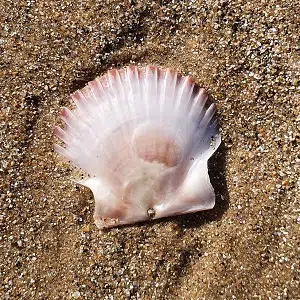
Intertidal Surveys – Exploring Holderness sandy beaches
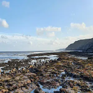
The Holderness coastline is one of the fastest eroding coastlines in Europe, but it is also a vital area for marine wildlife. Wading birds feed on small invertebrates along the shoreline, whilst shoals of fish swim by and lobsters hide away beneath boulders strewn across the sandy sea floor. The area is also key for renewable energy and communications infrastructure, with many pipelines and cables making landfall here.
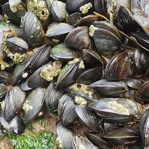
In autumn 2022, with financial support from East Riding of Yorkshire Council’s coastal monitoring programme, intertidal sediment surveys were carried out by the Hull Marine Laboratory. These surveys took samples of the sand at three different locations to find out what was in it – what lives there, what the sand is made of and how big the particles are. This information helps us to understand how important the dynamic Holderness coast is to the wider ecosystem, local communities and industry.
Read the full report
A microscopic safari
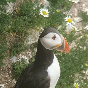
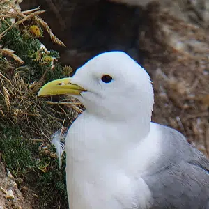
At first glance, it might look like the wide open beaches of the Holderness coast are quite empty. The dynamic shifting of sand, cliffs and sea certainly creates a difficult environment to live in, but there are still important species living within the sand itself. Across the three sites, the surveys found 17 different species (152 individuals). This included the speckled sealouse (pictured), a carnivorous predator which swims from the sand as the tide comes in to hunt along the sea floor, before retreating back into the beach.
Through their diverse feeding mechanisms and life cycles, species living in the sandy intertidal area are both affected by and actively influence the environment around them. These creatures consume organic matter, playing a vital role in nutrient and carbon cycling, whilst also being key prey species for other wildlife. As we learn more about these habitats and what we, as a society, receive from them, we will be better able to protect and look after them in the long-term.
Research Project Portfolio
The Research Working Group have put together a portfolio of potential and planned research projects, across the Yorkshire coast. These proposals highlight where further information would help us to drive forward environmental progress and help partners to collaborate across sectors. Some of the projects listed below are in development by the YMNP or by an individual partner organisation, others are simply ideas at an early stage of development. To find out more information about a specific project, please email [email protected].
Potential Projects (2021 update)
-
Topic Potential Research Status Sandeel stocks and movements in the North Sea (literature review) How have sandeel stocks in the North Sea changed over time (quantity and extent)? How does this impact seabirds and marine mammals? How is this linked with wider activities and environmental changes? Not active Flamborough Front How does the Flamborough Front tidal system impact Yorkshire coast species movements? Will climate change have a significant impact on this? Not active Urban Gulls What are the differences between urban and cliff-dwelling herring gulls in population extent/density and productivity? How can this inform future management and support positive engagement with communities? Not active Long-term changes in environmental variables at sea, as a result of climate change How is the sea-surface temperature changing overtime, both inshore and offshore? How is salinity changing? Are there changes in sediment transport and turbidity? Not locally active Cetecean Mapping Project to monitor and map cetacean presence, distribution and behaviour along the Yorkshire coast Active – Yorkshire Wildlife Trust Elasmobranch Monitoring What is the extent/distribution/behaviours etc. of elasmobranch species on the Yorkshire coast? Finfish Nursery and Spawning Grounds How can we improve understanding of finfish nursery/juvenile and spawning areas Blue carbon – sequestration Map and quantify carbon sequestration services from marine habitats; how can this information be used to inform policy and decision-making? Partially Active – Yorkshire Wildlife Trust -
Topic Potential Research Status Flamborough Head No Take Zone Habitat surveys to ground-truth existing data and support additional data collection Partially Active – YMNP Diet studies of auk species (Seabird Monitoring Programme) Comprehensive studies of auk diet during breeding season within F&FC SPA Partially Active – RSPB Flamborough Head SAC Reef Extent Updated map of chalk reef extent within Flamborough Head SAC and potential pressures on habitat Partially Active – NEIFCA and Yorkshire Wildlife Trust Holderness Inshore MCZ Habitat Mapping Confirm extent/distribution of peat and clay features within Holderness Inshore MCZ Not Active Seagrass Restoration on Spurn Assessing the effectiveness of restoring seagrass on Spurn Point, in terms of long-term extent/distribution and species colonisation/wider ecosystem services Active – Yorkshire Wildlife Trust MOTUS – Bird Migration at Flamborough Install equipment to monitor migratory birds tagged with Motus technology in Europe, and build capacity for local tagging on passerines and seabirds Partially Active – University of Hull Plastics in Seabird Nests What impact does plastic pollution have on the seabirds nesting within F&FC SPA? How are birds using plastic in nests? What is the rate of entanglement? Partially Active – YMNP Holderness Inshore MCZ Habitat Mapping Mapping of circalittoral rock features (high/moderate energy) Not Active -
Topic Potential Research Status Impacts of recreational activities Monitoring the frequency, type and extent of recreational activities on sensitive habitats and species Active – YMNP Shipwrecks of the Yorkshire Coast Raising awareness of important shipwrecks on Yorkshire coast. How do the shipwrecks of the Yorkshire coast support tourism and nature, through acting as artificial reefs? Not Active Microplastics in sediments To what extent are microplastics present in Yorkshire’s coastal sediments? What are the impacts of this on the ecosystem and food chain? Partially Active – SBC Ecological Enhancements How can ecological enhancements be used to ‘green’ hard sea defences and other concrete structures along the coast? How does this improve species diversity and WFD status? Active – YMNP and Environment Agency Yorkshire’s Traditional Fishing Cobles How the sea has shaped communities and fishing practices for generations, and the importance of maintaining that knowledge to inform future marine management Not Active Yorkshire’s Whaling History Exploring the uncomfortable past of whaling, to inform future marine management and understanding of human influences on environment Not Active Human impacts on shellfish Simulation of human presence/influence on shellfish species (lab-based) Active – Yorkshire Marine Research Centre Capturing traditional fishing knowledge How can traditional fisheries knowledge help to inform future marine management? Not Active
Other research projects on the coast include…